NWS ALERT: SEVERE THUNDERSTORMS EXPECTED LATE THIS AFTERNOON INTO THIS EVENING
By National Weather Service • Melbourne, Florida // January 22, 2017
NATIONAL WEATHER SERVICE ALERT

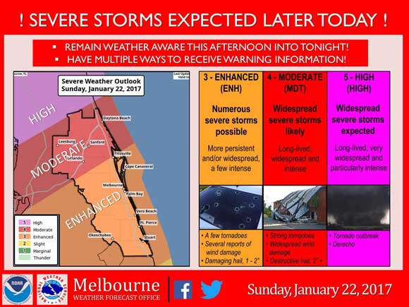
NATIONAL WEATHER SERVICE • MELBOURNE, FLORIDA – The threat for severe weather late this afternoon and evening has increased across east central Florida. Wind gusts up to 50 mph will impact east central Florida with locally damaging gusts between 60-80 mph possible.
Please review your emergency plans for severe thunderstorms and tornadoes and know what to do if a warning is issued for your area.
Fast moving thunderstorms are expected to impact east central Florida from Sunday afternoon into the evening.
Storms will be capable of producing damaging winds, isolated tornadoes, hail and frequent lightning.
Remain informed about Sunday’s forecast, and ensure you and your family have multiple ways to receive watch and warning information.
STAY TUNED TO SPACE COAST DAILY FOR UPDATES