Tropical Storm Isaias Expected to Form Near Leeward Islands, Gov. DeSantis Urges Floridians to Prepare for Possible Impact
By Space Coast Daily // July 29, 2020
tropical system is registering 45 mph max sustained winds

BREVARD COUNTY, FLORIDA – Tropical Storm Isaias is expected to form in the Caribbean Sea in the next few hours as it continues to move through the Leeward Islands on Wednesday.
The tropical system is registering 45 mph max sustained winds and moving to the west-northwest at 23 mph.
The potential path of Tropical Storm Isaiahs is projected to hit Florida late Saturday night into early Sunday morning.
Tropical Storm Warnings have been issued for Puerto Rico, Dominican Republican and Haiti.
At this time, experts do not expect Isaiahs to become a hurricane.
Gov. Ron DeSantis is urging Florida residents to monitor the tropical system as it draws closer to Florida and to prepare a kit for “at least 7 days of disaster supplies.”
“We are closely monitoring a tropical system with the Florida Division of Emergency Management. Forecasts are predicting heavy rainfall and strong winds will impact Florida beginning Saturday through early next week,” said Gov. DeSantis.
“Floridians should prepare now by having at least 7 days of disaster supplies.”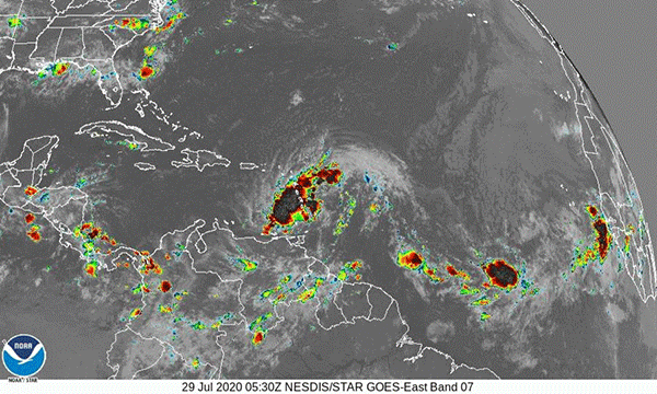
Tropical-storm-force winds are reportedly extending outward up to 275 miles.
A wind gust of 46 mph has been reported with the storm.
The Coast Guard recommends you keep the following things in mind for this hurricane season:
• Prepare a kit. Ensure you and your family have a disaster kit ready to go in case of an emergency. For more information on items to include in a kit visit Ready.gov preparedness tips.
• Get to know your surroundings. Know the elevation of your house and property. Hurricanes often bring storm surge, which is considered the greatest threat to property and life during any tropical storm. Know your communities’ evacuation routes and how you would evacuate to higher ground. For more information on potential storm surge areas visit NOAA’s storm surge site.
• Check the weather. The Coast Guard mobile app for boating safety is a tool to check marine weather from your phone. With the mobile app, you can check the weather at nearby NOAA buoys, which provides wind speed and direction along with wave height. Checking weather anytime you plan to get underway and while throughout your time on the water is highly recommended.
• Secure your boats. Review your hurricane plan with your local marina, ensure you have a plan to both bring your boat in and strap it down ashore or ensure it is properly equipped to ride out the storm at the marina.
Listen to local officials. If told to evacuate, do so immediately. You should consider evacuating if you live near bodies of water, a mobile home, or high-rise building.
ABOVE VIDEO: An above-normal 2020 Atlantic hurricane season is expected, according to forecasters with NOAA’s Climate Prediction Center, a division of the National Weather Service.

CLICK HERE FOR BREVARD COUNTY NEWS


