Hurricane Fiona Begins Moving Back Into Atlantic, Catastrophic Flooding in Puerto Rico
By Space Coast Daily // September 19, 2022
 BREVARD COUNTY, FLORIDA – Hurricane Fiona is beginning to re-enter the Atlantic after dumping an extreme amount of rain on Puerto Rico, causing catastrophic flooding in the area.
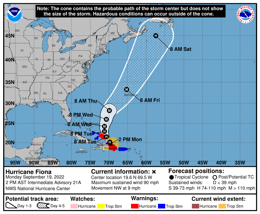
Fiona is moving toward the northwest near 9 mph.
This general motion is expected to continue through tonight, followed by a turn toward the north-northwest on Tuesday and to the north on Wednesday.
Fiona doesn’t pose as a threat to Florida.
On the forecast track, the center of Fiona will pass near or to the east of the Turks and Caicos on Tuesday.
Maximum sustained winds are near 90 mph with higher gusts. Strengthening is expected during the next few days, and Fiona is forecast to become a major hurricane by Wednesday.
Hurricane-force winds extend outward up to 30 miles (45 km) from the center and tropical-storm-force winds extend outward up to 140 miles. An AWOS observation station at Samana El Catey, Dominican Republic recently reported a wind gust to 98 mph.
According to the report, an additional 4 to 8 inches with local maximum of 15 inches is expected for southern Puerto Rico. The storm’s total has reached 12 to 20 inches with local maximum of over 30 inches in rain.


