WATCH: NASA Satellite Imagery Sees Remnants of Hurricane Irma Ready To Exit Eastern U.S.
By Rob Gutro, NASA's Goddard Space Flight Center // September 14, 2017
GOOD RIDDANCE TO HURRICANE IRMA!
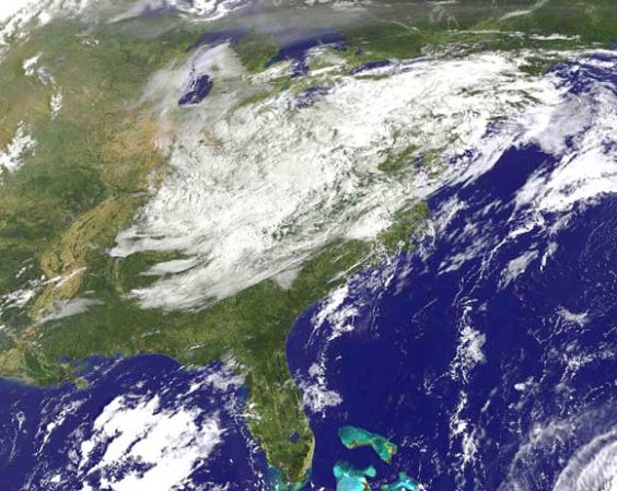
ABOVE VIDEO: This animation of NOAA’s GOES East satellite imagery, from Sept. 12 at 8:15 a.m. EDT to Sept. 14 ending at 8:30 a.m. EDT, shows Irma remnants moved from Missouri to the Mid-Atlantic and New England. Meanwhile Hurricane Jose continued making a loop in the Atlantic Ocean between Bermuda and the Bahamas. (NASA video)

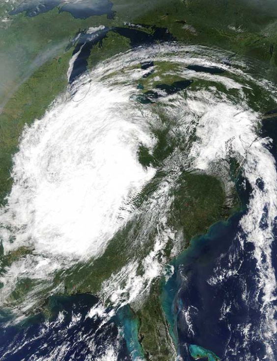
NASA – NASA’s Terra satellite and NOAA’s GOES East satellite have been just two of the fleet of satellites monitoring the life and death of former Hurricane Irma. Imagery from both of those satellites over two days show the movement of Irma’s remnant clouds.
On Sept. 13 at 12:20 p.m. EDT the Moderate Resolution Imaging Spectroradiometer of MODIS instrument aboard NASA’s Terra satellite provided a visible image of the remnants of Hurricane Irma over the U.S. Midwest.
The clouds stretched from Missouri to the southern tip of Lake Michigan in the Great Lakes.
The MODIS image was created by NASA’s MODIS Rapid Response Team at NASA’s Goddard Space Flight Center in Greenbelt, Maryland.

On Thursday, Sept. 14 at 3:34 a.m. EDT, the Discussion from the National Weather Service, Baltimore, Maryland/Washington, D.C. noted “The remnants of Irma will scoot toward the northeast and across Pennsylvania today then to southern New England tomorrow.”
On Sept. 14 at 9 a.m. EDT, NOAA’s GOES East satellite saw the remnant clouds associated with former Hurricane Irma moving over New England and the Mid-Atlantic.
The low pressure system associated with the remnant clouds was moving over upstate New York today, Sept. 14 and moving toward the U.S. East coast.
Irma’s remnants are expected to slide off the U.S. East coast on Friday, Sept. 15 and into the Atlantic Ocean.

CLICK HERE FOR BREVARD COUNTY NEWS


