Tropical Storm Isaias Likely to Become Category 1 Hurricane Before Impacting Brevard County: NHC
By Space Coast Daily // July 30, 2020
Hurricane Warning issued for the Bahamas
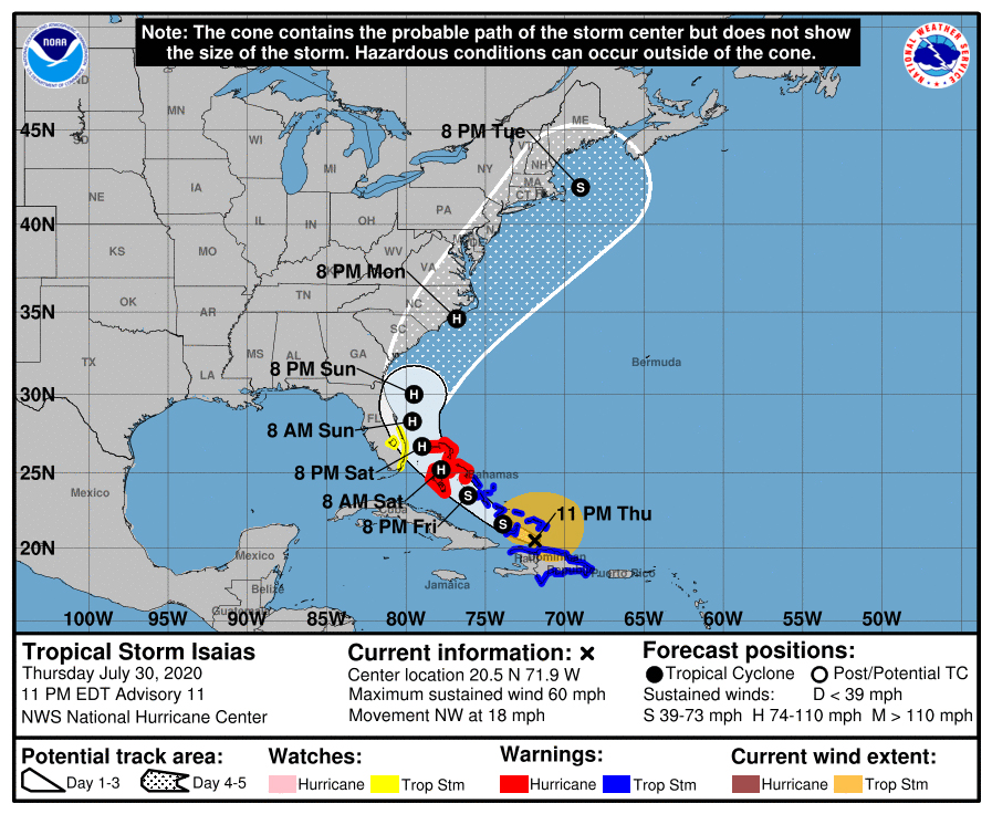
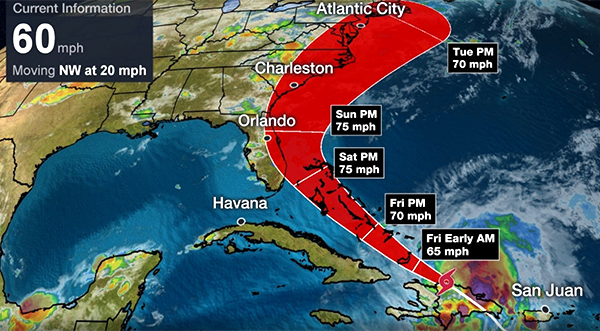
 BREVARD COUNTY, FLORIDA – National Hurricane Center is projecting Tropical Storm Isaias to become a Category 1 Hurricane by Friday night as it moves through the Bahamas and possibly impacting Brevard County by late Saturday night, heading into Sunday morning.
Brevard County is currently under a Tropical Storm Watch. Additional watches or warnings may be required for a portion of the Florida peninsula tonight or Friday.
The latest weather report shows Isaias registering 60 mph max sustained winds as it moves off of Hispaniola and churns towards the Bahamas on Friday.
The system is moving considerably quick at 20 mph to the northwest.
On Thursday, the port condition has been set to ‘X-Ray’ at Port Canaveral, which means sustained gale force winds generated by Tropical Storm Isaias may arrive within 48 hours.
The Bahamas are currently under a Hurricane Warning as experts at the National Hurricane Center expect Tropical Storm Isaias to strengthen early Friday morning before striking the Bahamas Friday night.
High wind shear could help breakdown Isaias as it moves off of Hispaniola or even knock it off course and send back into Atlantic. However, Isaias is moving into warmer water which could help intensify the storm and possibly become a a hurricane.
For Isaias to be labeled a Category 1 hurricane it must reach max sustained 74 mph
Florida will begin to feel the impact by Saturday, while other parts of east coast of the United States could be impacted by Isaias next week.
Stay Tuned To Space Coast Daily for Updates
Satellite Imagery of Tropical Storm Isaias
SPAGHETTI MODELS


CLICK HERE FOR BREVARD COUNTY NEWS