Coastal Flood Warning, High Surf Advisory in Effect for Brevard, Beware Dangerous Swimming and Surfing Conditions
By Space Coast Daily // September 19, 2020
NWS: large breaking waves of 6 to 11 feet are expected in the surf zone

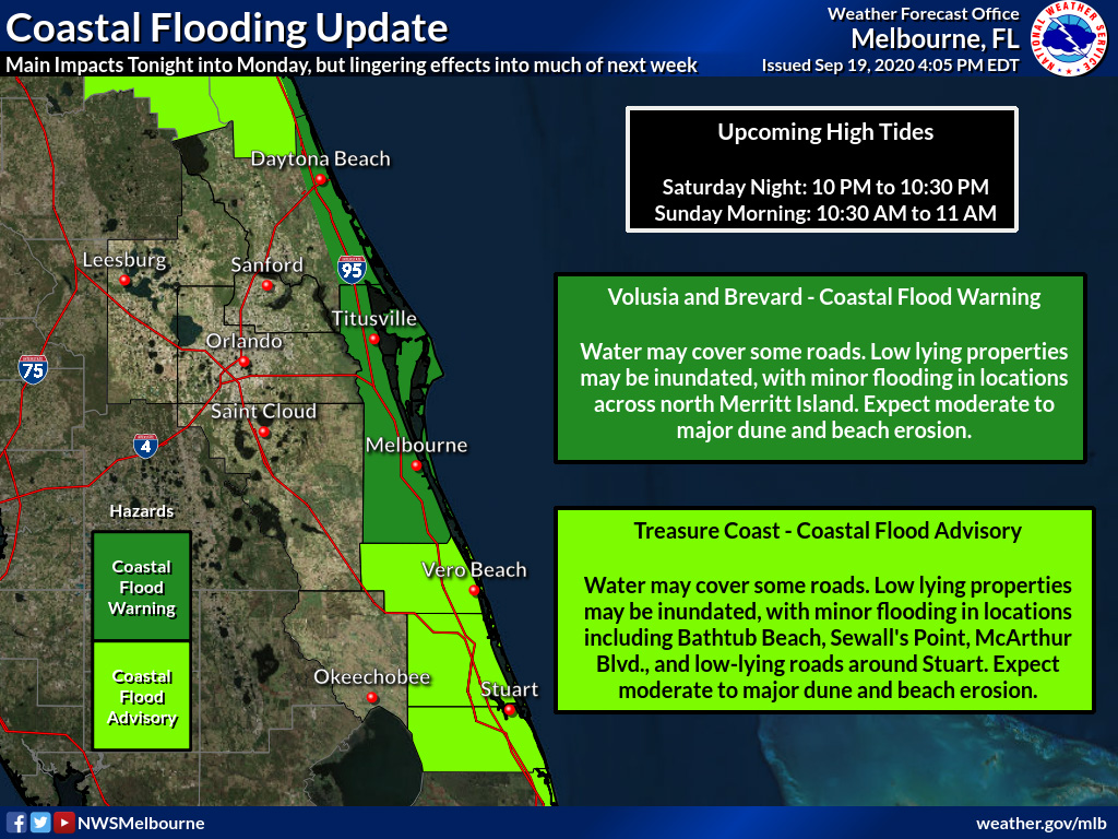
NATIONAL WEATHER SERVICE • MELBOURNE, FLORIDA – A long-duration event of high surf, dangerous rip currents and coastal flooding concerns will start Saturday night and lasts through Tuesday – with lingering effects into much of next week.
The highest impact will be around high tide. A Coastal Flood Warning in effect from 8 p.m. Saturday evening to 8 p.m. EDT Tuesday and a High Surf Advisory in effect from 8 p.m. Saturday evening to 8 p.m. EDT Tuesday.
For the Coastal Flood Warning, significant coastal flooding expected. For the High Surf Advisory, large breaking waves of 6 to 11 feet are expected in the surf zone.
Water may cover some roads and low-lying property may be inundated, with minor flooding possible in locations across north Merritt Island. Shoreline and dune erosion may occur.
Be aware of dangerous swimming and surfing conditions and localized beach erosion. Rip currents can sweep even the best swimmers away from shore into deeper water.
The main impacts of any coastal flooding or beach erosion will be greatest during the times of high tide. The next high tide cycles are from 10 p.m. to 10:30 p.m. this evening, and 10:30 a.m. to 11 a.m. Sunday morning.


