NWS UPDATE: Subtropical Storm Nicole Bears Down on Florida – Tropical Storm and Storm Surge Warnings Now in Effect for Brevard
By Space Coast Daily // November 8, 2022
Hurricane Watch remains in effect for Brevard County
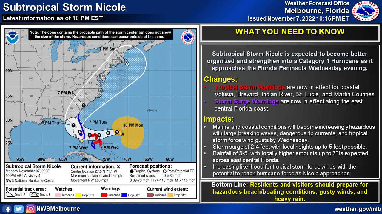
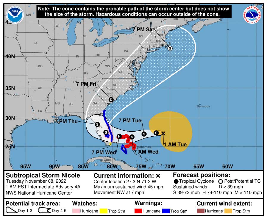
NATIONAL WEATHER SERVICE • MELBOURNE, FLORIDA – Subtropical Storm Nicole is expected to become more organized prior to landfall, with peak hazards Wednesday into Thursday, according to the National Weather Service in Melbourne.
Tropical Storm and Storm Surge Warnings are now in effect along coastal counties, including Brevard. A Hurricane Watch remains in effect for Brevard, Indian River, St. Lucie, and Martin counties, along with their adjacent Atlantic waters.
The National Hurricane Center said Nicole could impact Brevard County at or near hurricane strength. Winds are forecast to reach 70 mph within 60 hours, bringing it to just below hurricane strength of 75 mph, and it could make landfall anywhere from Brevard County south to Miami.
As it moves near the northwestern Bahamas and the east coast of Florida Wednesday and Thursday, there’s a potential for a dangerous storm surge, damaging winds, and heavy rainfall for a portion of those areas, according to the National Hurricane Center.
“Don’t let “subtropical” fool you, the storm has the potential to be at or near hurricane strength as it approaches the east coast of Florida later this week,” said National Weather Service officials in Melbourne.
“Peak impacts are expected Wednesday and Thursday, but conditions will begin to deteriorate well ahead of the storm on Tuesday. Those along areas of the Treasure Coast should prepare for the possibility of Cat 1 hurricane-force winds.”
Meanwhile, there’s no word yet on how this storm will affect the Nov. 14 launch of the Artemis I Moon mission from Kennedy Space Center.
STAY TUNED TO SPACE COAST DAILY FOR UPDATES
 Related Story:
HOT OFF THE PRESS! October 24, 2022 Space Coast Daily News – Brevard County’s Best Newspaper