Tropical Disturbance in Central Subtropical Atlantic Being Monitored for Development
By Space Coast Daily // June 23, 2025
40% chance of cyclone formation
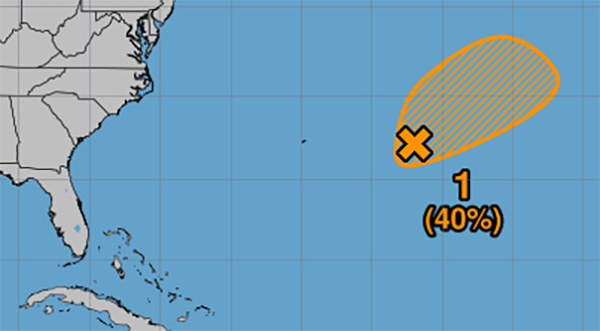
NATIONAL HURRICANE CENTER — As of 8 p.m. on Sunday, June 22, the National Hurricane Center is monitoring a weather system in the Central Subtropical Atlantic that has shown some signs of organization.
Currently located about 450 miles east of Bermuda, the low-pressure area is designated as Disturbance 1 and has been given a 40% chance of cyclone formation within the next seven days.
Satellite data earlier today revealed a well-defined surface circulation associated with this system, along with developing showers and thunderstorms.
While this suggests the potential for the formation of a short-lived tropical depression, forecasters note that the system is expected to encounter less favorable environmental conditions by Tuesday. These changing conditions could limit further development.
Despite the uncertainty, the disturbance is forecast to move slowly toward the northeast at speeds between 5 and 10 miles per hour, remaining over open waters in the central Atlantic.
The National Hurricane Center classifies the chance of tropical or subtropical cyclone formation at 40% through both the 48-hour and seven-day outlook periods.
While there is currently no threat to land, residents and maritime interests are advised to stay informed as the situation evolves.
 Related Story:
HOT OFF THE PRESS! June 16, 2025 Space Coast Daily News – Brevard County’s Best Newspaper