Hurricane Ian Makes Landfall near Fort Myers as Category 4 System
By Space Coast Daily // September 28, 2022
Ian carrying 115 mph max sustained winds
 BREVARD COUNTY, FLORIDA – Hurricane Ian continues to trek through Florida with 115 mph max sustained winds, with the eye making an impact Brevard County around 2 p.m. Thursday.
Ian is moving toward the north-northeast near 8 mph. On the forecast track, the center of Ian is expected to move across central Florida tonight and Thursday morning and emerge over the western Atlantic by late Thursday.
Ian is forecast to turn northward on Friday and approach the northeastern Florida, Georgia and South Carolina coasts.
Maximum sustained winds have decreased to near 115 mph with higher gusts. Ian is a category 3 hurricane on the Saffir-Simpson Hurricane Wind Scale.
Further weakening is expected for the next day or so, but Ian could be near hurricane strength when it moves over the Florida East coast tomorrow, and when it approaches the northeastern Florida, Georgia and South Carolina coasts on Friday.
Hurricane-force winds extend outward up to 50 miles from the center and tropical-storm-force winds extend outward up to 175 miles (280 km).
A University of Florida Coastal Monitoring Program wind tower near Punta Gorda recently reported sustained winds of 54 mph with a gust to 91 mph. A private weather station in Joshua recently measured a wind gust to 89 mph.

The Space Coast Daily Weather Report is brought to you by Gorilla Roofing, Inc., a Florida roofing company you can trust.
Thirty years of experience in residential and commercial Space Coast roofing services sets Gorilla Roofing apart from the rest. As a Florida-owned family business, Gorilla Roofing prides itself on quality workmanship and superior customer service experience for every customer.
No matter how big or small the job, Gorilla Roofing, Inc. values your business and guarantees you will be 100% satisfied from start to finish as the Gorilla Roofing team of professionals walks you through the process.
Located at 38 Nevins Court on Merritt Island, Florida, you can reach Gorilla Roofing by calling 321-613-5158 or emailing info@mygorillaroofing.com.
 Related Story:
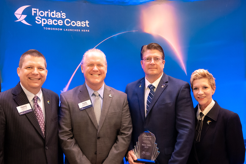
HOT OFF THE PRESS! August 29, 2022 Space Coast Daily News – Brevard County’s Best Newspaper