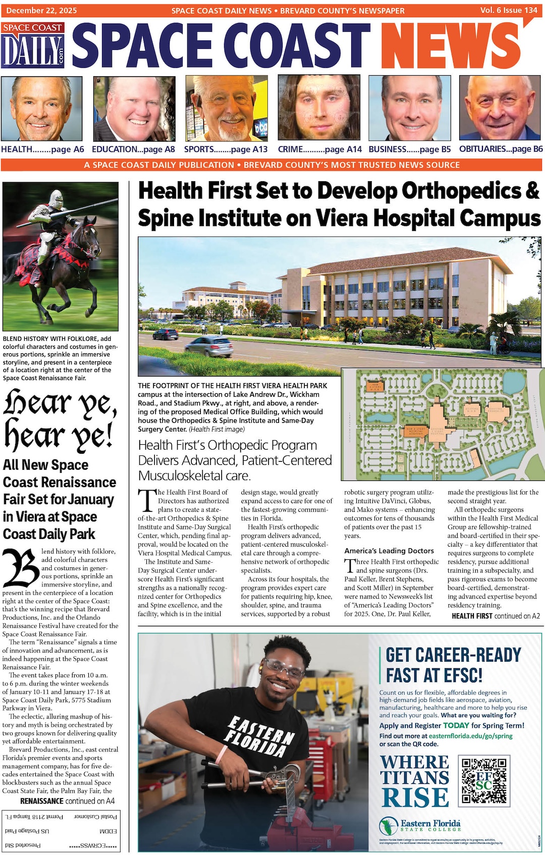
NASA to Preview First of it’s Kind U.S.-India Radar Mission Ahead of Rocket Launch Set for Late July
By Space Coast Daily // July 18, 2025
Launch is targeted for no earlier than late July

(NASA) — NASA will host a conference at 12 p.m. Monday, July 21, to discuss the upcoming NASA-ISRO Synthetic Aperture Radar mission, which will lift off from ISRO’s Satish Dhawan Space Centre in Sriharikota, on India’s southeastern coast.
Launch is targeted for no earlier than late July.
The Earth-observing satellite, a first-of-its-kind collaboration between NASA and the Indian Space Research Organization, carries an advanced radar system that will help protect communities by providing a dynamic, three-dimensional view of Earth in unprecedented detail and detecting the movement of land and ice surfaces down to the centimeter.
NASA’s Jet Propulsion Laboratory in Southern California will stream the briefing live on its X, Facebook, and YouTube channels. Learn how to watch NASA content through a variety of platforms, including social media.
Participants in the conference include:
● Nicky Fox, associate administrator, Science Mission Directorate, NASA Headquarters
● Karen St. Germain, director, Earth Science Division, NASA Headquarters
● Wendy Edelstein, deputy project manager, NISAR, NASA JPL
● Paul Rosen, project scientist, NISAR, NASA JPL
With its two radar instruments: an S-band system provided by ISRO and an L-band system provided by NASA, NISAR will use a technique known as synthetic aperture radar to scan nearly all the planet’s land and ice surfaces twice every 12 days.
Each system’s signal is sensitive to different sizes of features on Earth’s surface, and each specializes in measuring different attributes, such as moisture content, surface roughness, and motion.
These capabilities will enable scientists to better understand the processes involved in natural hazards and catastrophic events, such as earthquakes, volcanic eruptions, land subsidence, and landslides.
Additionally, NISAR’s cloud-penetrating ability will aid in urgent responses to communities during weather disasters, such as hurricanes, storm surges, and flooding. The detailed maps the mission creates will also provide information on both gradual and sudden changes occurring on Earth’s land and ice surfaces.
Managed by Caltech for NASA, JPL leads the U.S. component of the NISAR project and provided the L-band SAR. NASA JPL also provided the radar reflector antenna, the deployable boom, a high-rate communication subsystem for science data, GPS receivers, a solid-state recorder, and a payload data subsystem.
NASA’s Goddard Space Flight Center in Greenbelt, Maryland, manages the Near Space Network, which will receive NISAR’s L-band data.
Multiple ISRO centers have contributed to the NISAR project. The Space Applications Centre is providing the mission’s S-band SAR. The U R Rao Satellite Centre provided the spacecraft bus. The rocket is from Vikram Sarabhai Space Centre, launch services are through Satish Dhawan Space Centre, and satellite mission operations are by the ISRO Telemetry Tracking and Command Network. The National Remote Sensing Centre is responsible for S-band data reception, operational products generation, and dissemination.
To learn more about NISAR, CLICK HERE.
 Related Story:
HOT OFF THE PRESS! July 14, 2025 Space Coast Daily News – Brevard County’s Best Newspaper