Rain, Storms and Flooding Threat Increase Across Brevard County on Monday
By Space Coast Daily // June 15, 2026
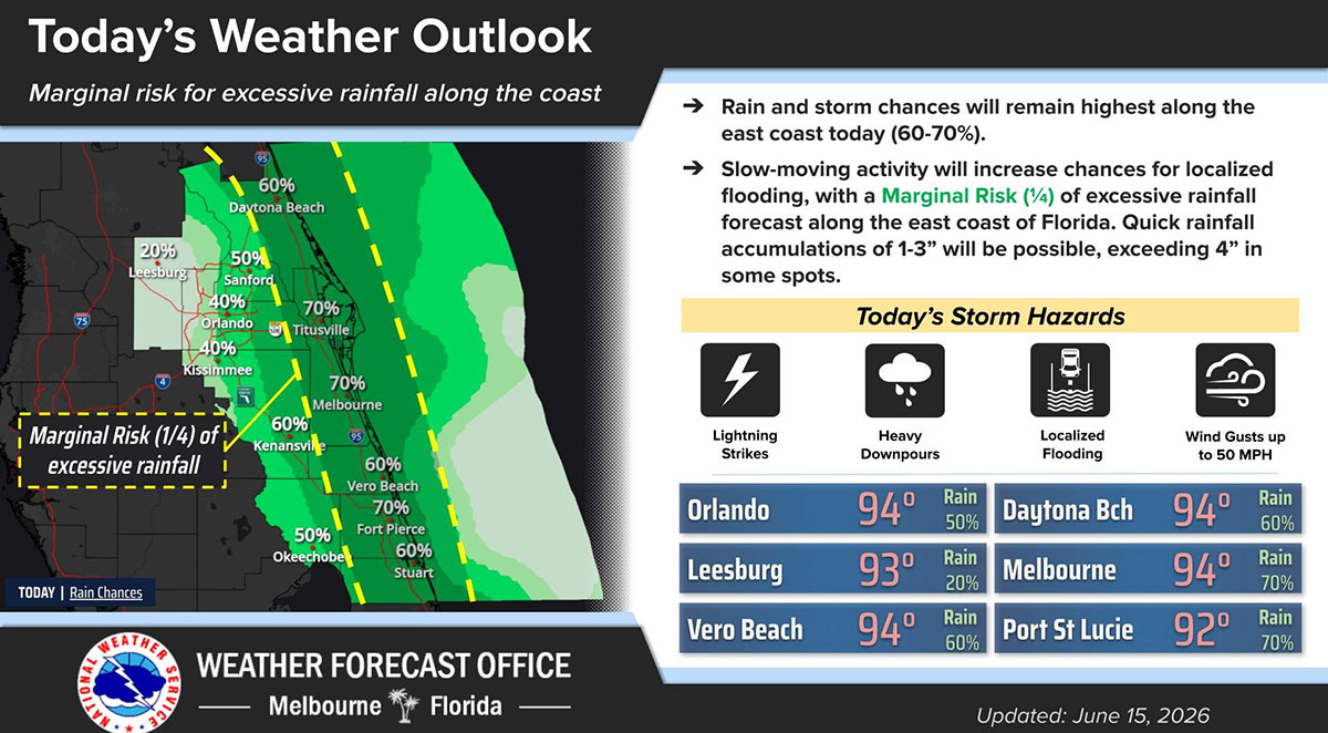
BREVARD COUNTY, FLORIDA – Brevard County could see a busy day for scattered showers and thunderstorms on Monday as forecasters warn of a marginal risk for excessive rainfall and localized flooding.
According to the National Weather Service in Melbourne, rain and storm chances will remain highest along the east coast, ranging from 60% to 70%, with Brevard County expected to see some of the most active weather during the afternoon and evening hours.
Forecasters say slow-moving thunderstorms will increase the risk of heavy rainfall, producing quick accumulations of 1 to 3 inches of rain, with isolated locations potentially receiving more than 4 inches.
As a result, portions of east-central Florida have been placed under a Marginal Risk (Level 1 of 4) for excessive rainfall.
The primary storm hazards Monday include:
-
Frequent lightning strikes
-
Heavy downpours
-
Localized flooding of roads and low-lying areas
-
Wind gusts up to 50 mph


