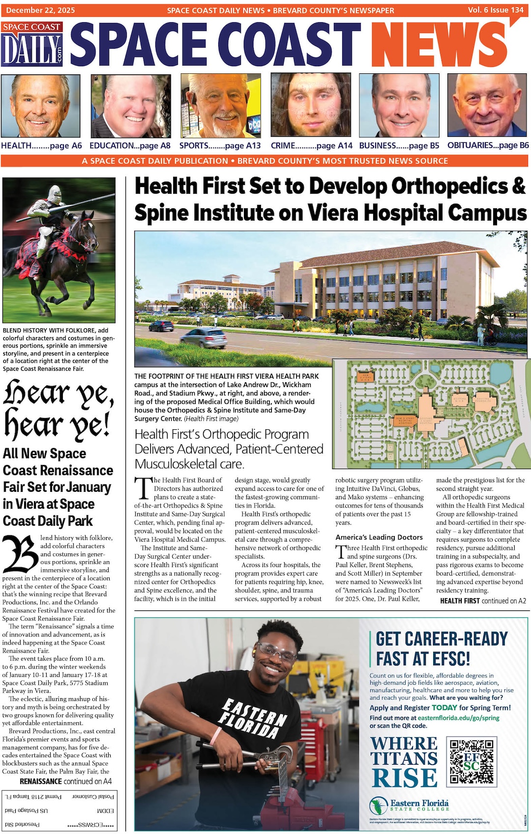
Hurricane Irma Poised To Strike Florida Keys, Then Naples as CAT 3 – Will Impact Brevard Saturday Night
By Space Coast Daily // September 9, 2017
NATIONAL HURRICANE CENTER 8 P.M. UPDATE

BREVARD COUNTY, FLORIDA – Hurricane Irma is centered at 8 p.m. EDT about 110 miles southeast of Key West. Currently, its winds have decreased to 120 mph, which makes it a Category 3 storm.
The National Hurricane Center has Irma on a collision course with the Florida Keys, passing just east of Key West late Saturday night into Sunday.
The storm is then project to strike Southwest Florida near Sanibel and Naples about 2 p.m. Sunday, and then hug the west coast of Florida, passing directly over Tampa Bay in the early hours of Monday morning.
Rain and wind impact of the storm will start in Brevard County Saturday and into Saturday night. The strongest wind will be felt in Central Florida overnight Sunday through midday Monday.
Radar loops indicate that Irma has temporarily slowed down, but the hurricane has been moving toward the west-northwest near 7 mph since earlier today.
A northwest motion is expected to begin tonight with a turn toward the north-northwest on Sunday. On the forecast track, the core of Irma will continue to move near the north coast of Cuba during the next few hours, and should be near the Florida Keys Sunday morning.
A NOAA Hurricane Hunter aircraft has found that Irma’s intensity is a little lower, and the maximum sustained winds are estimated to be near 120 mph with higher gusts.
Irma is a CAT 3 hurricane on the Saffir-Simpson Hurricane Wind Scale. Irma is forecast to restrengthen once it moves away from Cuba and remain a powerful hurricane as it approaches Florida.
Hurricane-force winds extend outward up to 70 miles from the center, and tropical-storm-force winds extend outward up to 195 miles. Marathon International Airport recently reported a sustained wind of 48 mph and a gust to 67 mph. The minimum central pressure based on aircraft data is 932 mb (27.52 inches).

The water is expected to reach the following HEIGHTS ABOVE GROUND if the peak surge occurs at the time of high tide:
• Cape Sable to Captiva…10 to 15 ft
• Captiva to Ana Maria Island…6 to 10 ft
• Card Sound Bridge through Cape Sable, including the Florida Keys…5 to 10 ft
• Ana Maria Island to Clearwater Beach, including Tampa Bay…5 to 8 ft
• North Miami Beach to Card Sound Bridge, including Biscayne Bay…4 to 6 ft
• South Santee River to Fernandina Beach…4 to 6 ft
• Clearwater Beach to Ochlockonee River…4 to 6 ft
• Fernandina Beach to North Miami Beach…2 to 4 ft
A Hurricane Warning is in effect for Fernandina Beach southward around the Florida peninsula to Indian Pass including the Florida Keys, Lake Okeechobee and Florida Bay; the Cuban provinces of Camaguey, Ciego de Avila, Sancti Spiritus,Villa Clara, Matanzas, and Havana, Andros Island, Bimini and Grand Bahama.
A Hurricane Watch is in effect for north of Fernandina Beach to Edisto Beach and west of the Aucilla River to Indian Pass.
A few tornadoes are possible this evening and tonight over south Florida, expanding northward into central Florida on Sunday.