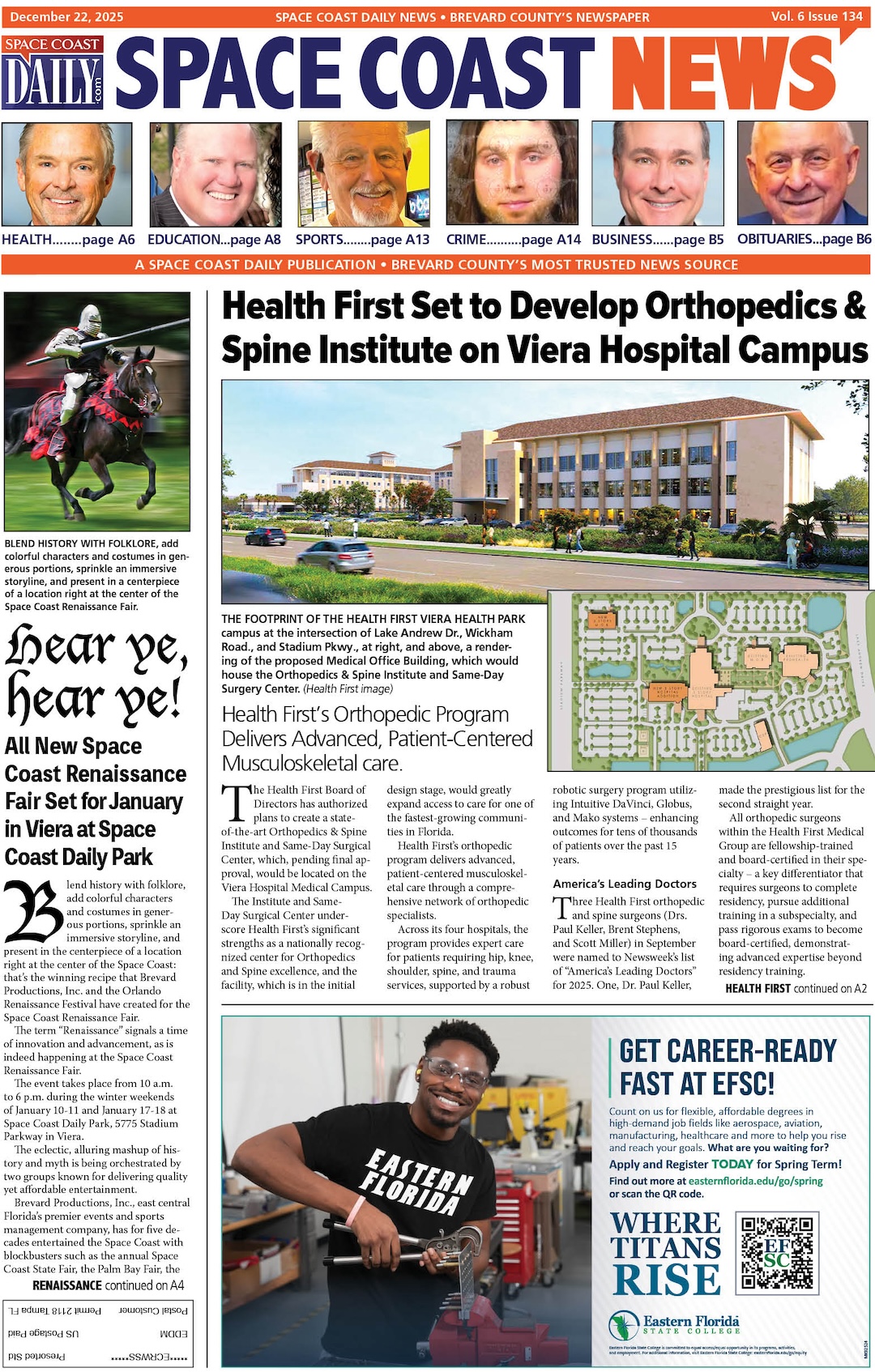
VIDEO: Hurricane Irma Eye Wall Prepares To Hit Fort Myers, Could See Storm Surge As High As 15 Feet
By Fox News // September 10, 2017
ABOVE VIDEO: Chief hurricane specialist at the National Hurricane Center updated Hurricane Irma’s track.
(FOX NEWS) – Hurricane Irma gathered new strength early Sunday as it approached the Florida Keys – regaining Category 4 status as the storm that left a deadly path of destruction across the Caribbean swirled on a projected path that puts Florida’s west coast under threat for a direct hit.
In its 8 a.m. ET advisory, the National Hurricane Center said the storm was about 20 miles south-southeast of Key West, with sustained winds of 130 miles per hour, and headed for the Florida peninsula northwest at 8 mph.
The U.S. National Hurricane Center said in a public advisory that the center of the storm remained offshore but was going to make landfall soon.
The latest forecasts project Irma will hug Florida’s western coast off Fort Myers through the day Sunday, with the eye wall reaching the Tampa Bay area by the end of the day.
“One of the biggest concerns with Irma is the storm surge, areas from Naples to Fort Myers will see a surge as high as 15 feet,” Fox News Meterologist Adam Klotz said Sunday.
CLICK HERE TO READ FULL ARTICLE