NWS: Winds 25 to 35 MPH, With Gusts in Excess of 45 MPH, 1-3-Inches of Rain Expected for Brevard Wednesday
By Space Coast Daily // August 30, 2023
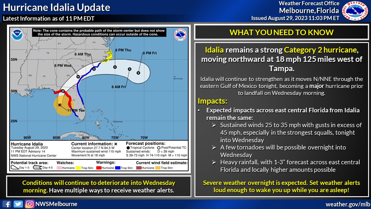
Hurricane Idalia effects: A few tornadoes possible, 1-3” of rainfall in Brevard

NATIONAL HURRICANE CENTER – Hurricane Idalia is expected to hit Florida as an extremely dangerous Category 4 storm when it makes landfall mid-to-late Wednesday morning along the Florida’s Big Bend region, according to the 11 p.m. ET advisory from the National Hurricane Center.
Idalia outer bands are expected to increase across east central Florida tonight into Wednesday morning.
The main threats for east central Florida will be:
■ Winds 25 to 35 mph with gusts in excess of 45 mph, especially in the strongest squalls
■ A few tornadoes possible
■ 1-3” of rainfall, with locally higher amounts
Idalia has rapidly intensified over the warm waters of the Gulf of Mexico as it bears down on Florida’s west coast, packing 110 mph winds as of 11 p.m. ET.
The National Hurricane Center said Idalia’s landfall strength and storm surge could possibly reach all-time levels along the Florida’s Big Bend region.
In the National Hurricane Center’s 11 p.m. advisory, the center of the storm was located about 125 miles west-southwest of Tampa and 185 miles south of Tallahassee. The window for a possible landfall has been pushed to mid-to-late Wednesday morning.
Hurricane-force winds extend outward up to 25 miles from the center and tropical-storm-force winds extend outward up to 160 miles. The combination of a dangerous storm surge and the tide will cause normally dry areas near the coast to be flooded by rising waters moving inland from the shoreline, with heights of 12 to 15 feet above ground.


