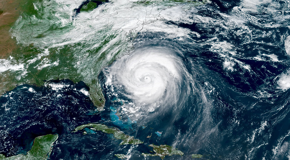
Forecasters with NOAA’s National Weather Service are predicting a below-normal hurricane season for the Atlantic basin this year.
BREVARD COUNTY • MELBOURNE, FLORIDA – Forecasters with NOAA’s National Weather Service are predicting a below-normal hurricane season for the Atlantic basin this year.
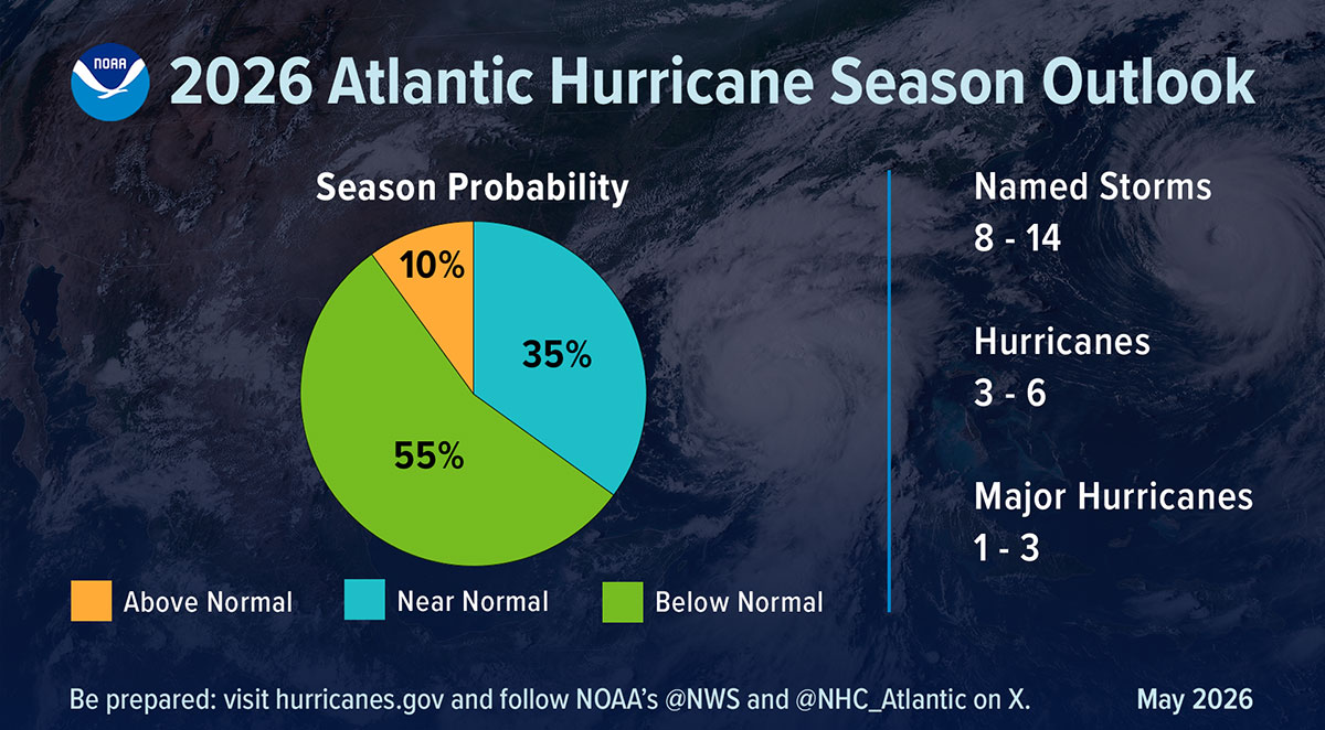
NOAA’s outlook for the 2026 Atlantic hurricane season, which runs June 1 to November 30, predicts a 35% chance of a near-normal season, a 10% chance of an above-normal season, and a 55% chance of a below-normal season.
The agency is forecasting a total of 8-14 named storms (winds of 39 mph or higher). Of those, 3-6 are forecast to become hurricanes (winds of 74 mph or higher), including 1-3 major hurricanes (category 3, 4 or 5 with winds of 111 mph or higher). NOAA has a 70% confidence in these ranges. An average season has 14 named storms with seven hurricanes, including three major hurricanes.
“With the most advanced forecast modeling and hurricane tracking technologies, NOAA and the National Weather Service are prepared to deliver real-time storm forecasts and warnings,” said Commerce Secretary Howard Lutnick. “Our experts are integrating cutting-edge tools to ensure communities in the path of storms receive the earliest, most accurate information possible.”
“NOAA’s rapid integration of advanced technology, including AI-based weather models, drones, and next-generation satellite data will deliver actionable science to safeguard the lives and livelihoods of the American people,” said NOAA Administrator Neil Jacobs, Ph.D. “These new capabilities, combined with the unmatched expertise of our National Weather Service forecasters, will produce the most accurate forecasts possible to protect communities in harm’s way.”
A summary infographic showing hurricane season probability and numbers of named storms predicted from NOAA’s 2026 Atlantic Hurricane Season Outlook.
Key factors driving NOAA’s forecast
The Atlantic season is expected to be below-normal due to competing factors. El Niño is expected to develop and intensify during the hurricane season, while ocean temperatures in the Atlantic are expected to be slightly warmer than normal and trade winds are likely weaker than average.
El Niño conditions tend to support less tropical storms and hurricanes, while warmer ocean temperatures and low winds support a more active year.
“Although El Niño’s impact in the Atlantic Basin can often suppress hurricane development, there is still uncertainty in how each season will unfold,” said NOAA’s National Weather Service Director Ken Graham. “That is why it’s essential to review your hurricane preparedness plan now. It only takes one storm to make for a very bad season.”
NOAA’s outlook is for overall seasonal activity based on large-scale weather and climate patterns. It does not indicate where or when any storms may affect land as that is determined by short-term and variable weather patterns is not a landfall forecast.
“Preparing now for hurricane season — and not waiting for a storm to threaten — is essential for staying ahead of any storm. Visit weather.gov/safety and Ready.gov for important preparedness information,” added Graham.
New and enhanced communication products this season
• NOAA’s National Hurricane Center (NHC) will implement an improved version of the tropical cyclone forecast cone graphic that will now include tropical storm and hurricane watches and warnings for inland areas for the continental United States, Hawaii, Puerto Rico and the U.S. Virgin Islands.
• NHC will begin testing an experimental version of the tropical cyclone track forecast cone that will capture a greater range of possibilities for the track of the storm by incorporating uncertainties for both direction of movement and timing.
• NHC will provide new products and services for the Hawaiian Islands to include storm surge watches and warnings, and a peak storm surge graphic. These will be publicly available for the main Hawaiian Islands on hurricanes.gov.
Advancements to hurricane analysis and forecasts
• NOAA, in collaboration with the Unified Forecast System community, is testing an experimental high-resolution Seasonal Forecast System that utilizes the latest modeling technology and new methods to assess the evolution of the global ocean-atmosphere system. The system is helping forecasters better simulate tropical storms and hurricanes, and more effectively predict the number of hurricanes and major hurricanes.
• NOAA’s Atlantic Oceanographic and Meteorological Laboratory (AOML) is using machine learning to quality-control data collected from tail Doppler radar — a specialized radar system mounted on the back of NOAA’s “Hurricane Hunter” aircraft. This new method gathers more than 25% more meteorological data than the current method and leads to more high-quality data to support structure and wind analysis by forecasters.
Innovative technologies for this year
• NOAA’s Office of Water Prediction high-resolution Flood Inundation Mapping (FIM) services provide emergency managers visualizations of those streets and neighborhoods likely to go underwater. FIM covers 60% of the U.S. population and will expand to nearly 100% by late September 2026.