BREVARD COUNTY, FLORIDA – Storm chances are expected to increase across East Central Florida on Tuesday, with the greatest coverage anticipated from Osceola and Brevard counties northward.
A few storms could become strong, producing locally damaging wind gusts, frequent lightning and heavy rainfall, according to the National Weather Service in Melbourne.
Periods of torrential rain may lead to temporary flooding, particularly along roadways, in low-lying areas and locations with poor drainage. Motorists should avoid driving through flooded roads and seek shelter indoors when thunder is heard.
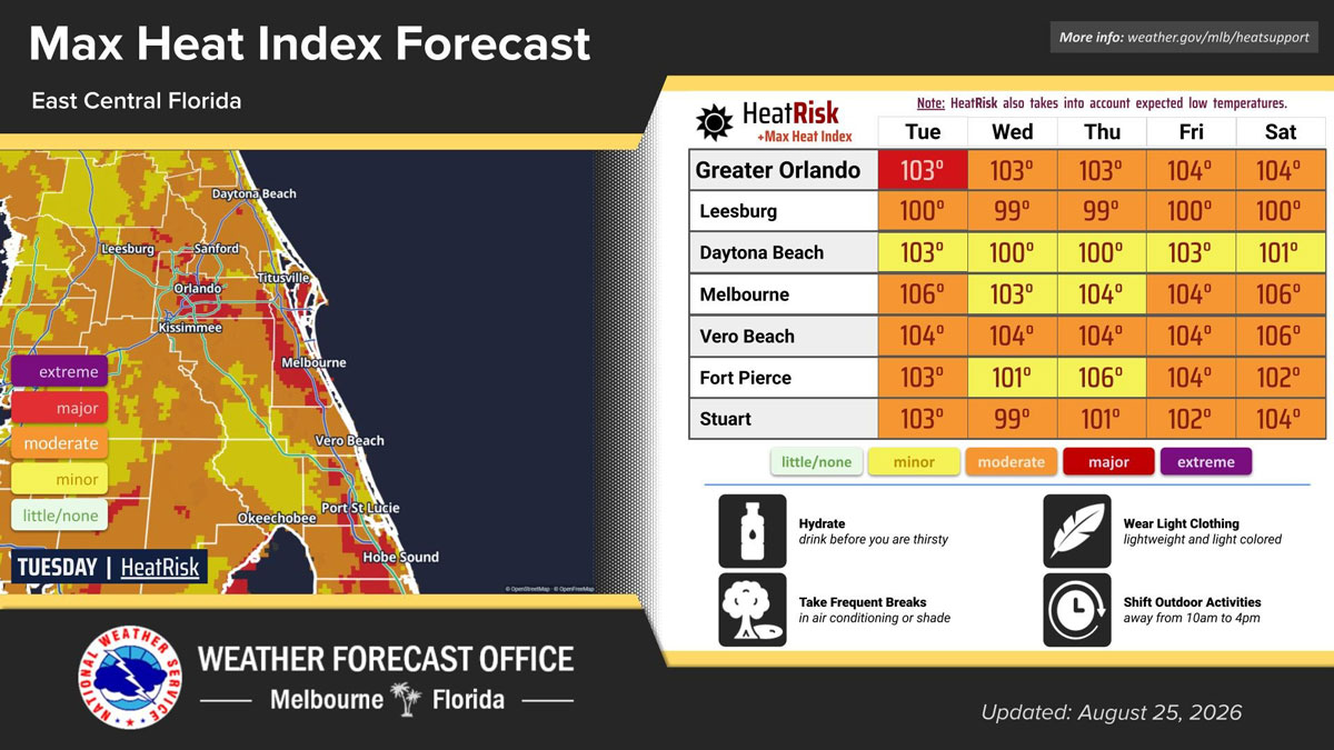
Before storms develop, temperatures are forecast to climb into the low to mid-90s. High humidity will make conditions feel considerably hotter, with peak heat index values potentially reaching 107 degrees.
Melbourne is forecast to experience a maximum heat index near 106 degrees Tuesday. Residents working or exercising outdoors should drink plenty of water, wear lightweight clothing and take frequent breaks in air conditioning or shade.
When possible, strenuous outdoor activities should be moved away from the hottest part of the day.
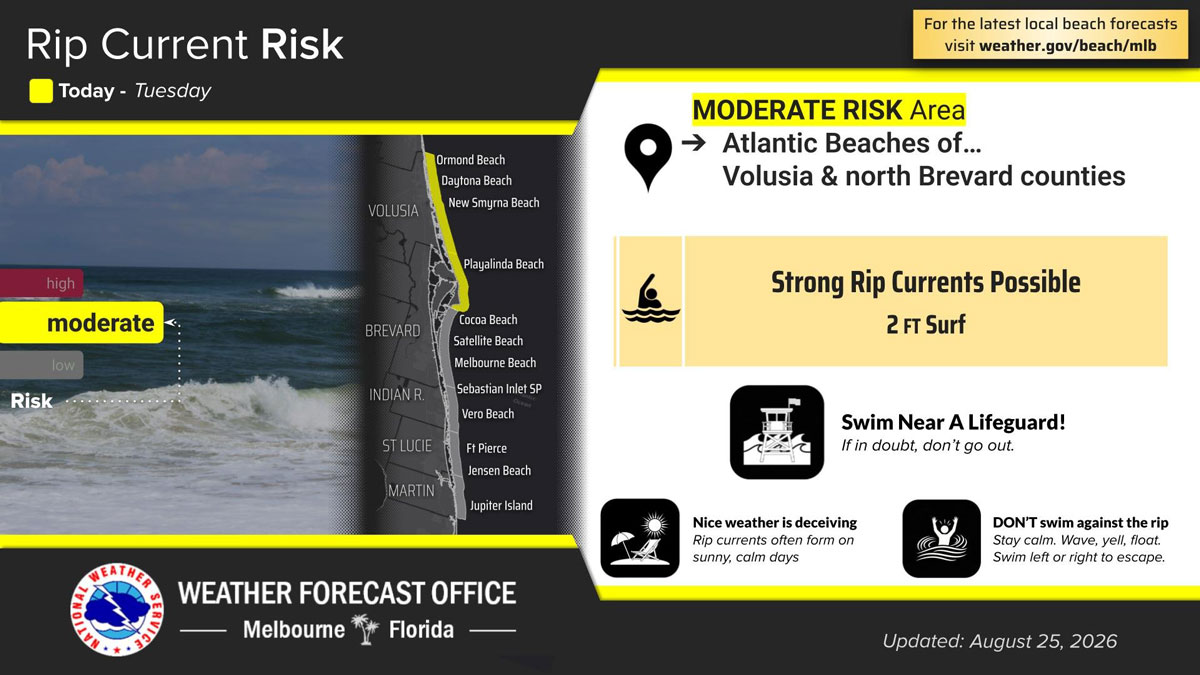
Beachgoers should also remain alert to a moderate risk of dangerous rip currents along the Atlantic beaches of Volusia and northern Brevard counties. Surf heights around 2 feet are expected.
Officials recommend swimming near a lifeguard and never entering the ocean alone. Anyone caught in a rip current should remain calm, avoid swimming directly against it and move parallel to the shoreline until free of the current.