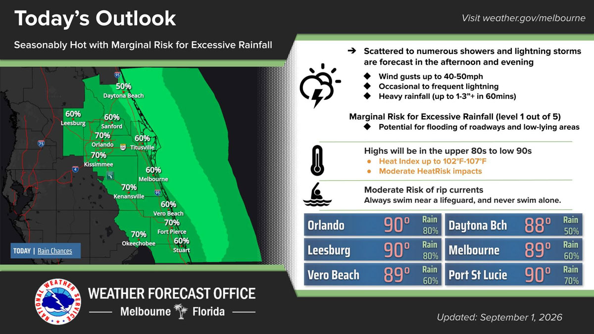
Scattered to numerous showers and lightning storms are forecast across Brevard County and East Central Florida this afternoon and evening, with rain chances expected to diminish around 9 p.m. (NWS Image)
BREVARD COUNTY, FLORIDA – Scattered to numerous showers and lightning storms are forecast across Brevard County and East Central Florida this afternoon and evening, with rain chances expected to diminish around 9 p.m.
A couple to a few storms could become strong, producing wind gusts of 40 to 50 mph, occasional to frequent lightning and heavy rainfall.
Some locations could receive 1 to 3 inches or more of rain within 60 minutes, potentially causing temporary flooding on roadways and in low-lying or poorly drained areas. The region is under a marginal risk for excessive rainfall.
High temperatures will reach the upper 80s to low 90s, with heat index values ranging from 102 to 107 degrees. A Moderate HeatRisk is in effect, meaning prolonged exposure could affect people sensitive to heat.
Residents should stay hydrated, limit strenuous outdoor activity and move indoors when thunder is heard.
A Moderate Risk for rip currents also remains in effect along Brevard County beaches. Beachgoers should swim near a lifeguard, avoid entering the ocean alone and follow posted warnings.