
Hurricane Isaias Packs 120 MPH Winds, Expected to Strike Florida Panhandle Friday Evening
By Zach Clark // October 9, 2026
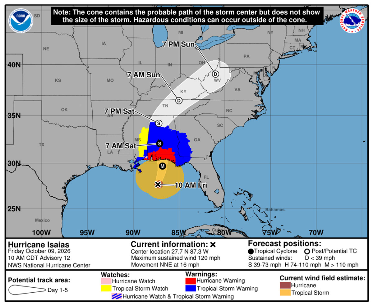 Hurricane Isaias is expected to make landfall along the western Florida Panhandle coast Friday evening, bringing life-threatening storm surge, devastating winds and potentially severe flooding to portions of the northern Gulf Coast.
According to the National Hurricane Center’s 10 a.m. CDT advisory, Isaias was a Category 3 hurricane with maximum sustained winds of 120 mph and higher gusts. The center was located about 195 miles south of Pensacola, moving north-northeast at 16 mph.
Forecasters expect Isaias to approach the northern Gulf Coast Friday afternoon and make landfall within the hurricane warning area Friday evening. Although fluctuations in intensity are possible, the storm is expected to remain at or near major hurricane strength when it reaches the coast.
Residents in threatened areas should rush preparations to completion and promptly follow evacuation orders and other instructions from local officials.
Storm Surge Could Reach 9 Feet
A storm surge warning remains in effect from the mouth of the Mississippi River to the Suwannee River in Florida.
The combination of storm surge and high tide could push water 6 to 9 feet above normally dry ground between the Alabama–Florida border and Grayton Beach, with large, dangerous waves accompanying the rising water.
Other projected surge heights include:
-
Grayton Beach to Indian Pass: 4 to 7 feet.
-
Indian Pass to the Steinhatchee River: 4 to 6 feet.
-
Dauphin Island to the Alabama–Florida border: 4 to 6 feet.
-
Steinhatchee River to the Suwannee River: 3 to 5 feet.
-
Mouth of the Mississippi River to Dauphin Island: 3 to 5 feet.
-
Lower Mobile Bay: 3 to 5 feet.
-
Upper Mobile Bay: 2 to 4 feet.
-
Suwannee River to Yankeetown: 2 to 4 feet.