‘Grace’ Becoming More Organized in Atlantic, Tropical Storm Watch Issued for Leeward Islands
By Space Coast Daily // August 13, 2021
carrying 35 mph max sustained winds

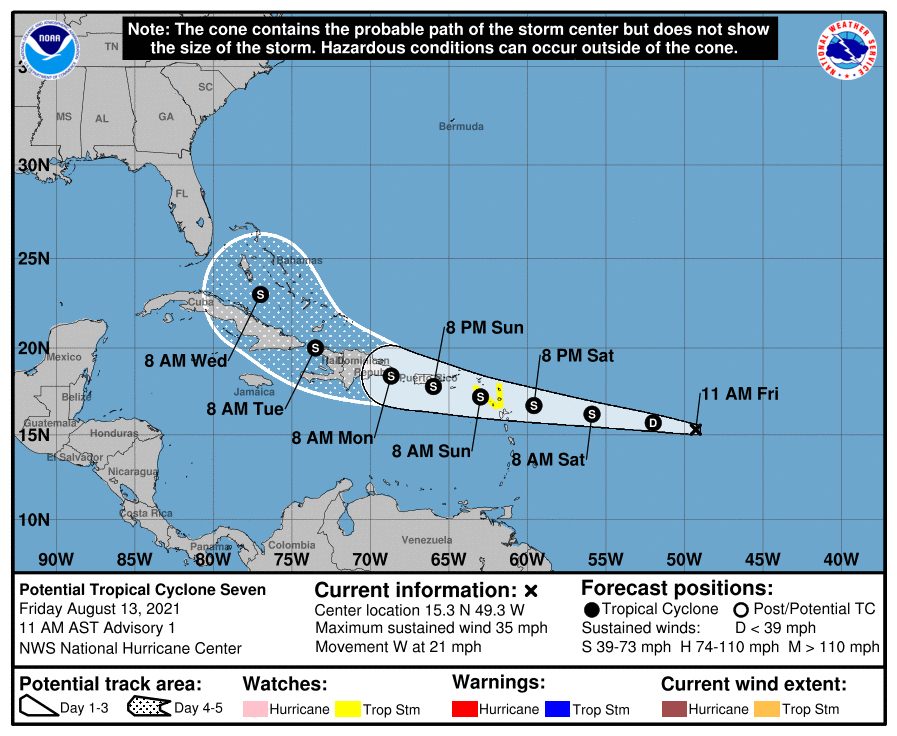
BREVARD COUNTY, FLORIDA – The potential tropical cyclone ‘Grace’, located about 800 miles east of Leeward Islands, is currently carrying showers and thunderstorms that have become a little better organized since Thursday.
The system is carrying 35 mph max sustained winds.
NHC says the environmental conditions are becoming more conducive for additional development, and a tropical depression is likely to form over the next day or two while moving toward the west or west-northwest at about 20 mph.
The system is expected to reach portions of the Leeward Islands Saturday night and then the Virgin Islands and Puerto Rico Sunday and Sunday night.
Tropical storm watches or warnings could be required later today or tonight for portions of the Leeward Islands, the Virgin Islands, and Puerto Rico, since strong winds and heavy rainfall are likely to spread across those areas over the weekend, regardless of the system’s development.
Brevard County residents and visitors should continue to monitor the development of this system as it develops. Should ‘Grace’ impact our area, it would impact Brevard County on Thursday and/or early Friday morning.
Stay tuned to Space Coast Daily for updates
National Hurricane Center contributed to this report.


