Cold Front to Bring Over 40 MPH Wind Gusts, Rough Surf to Brevard County Over the Weekend
By Space Coast Daily // March 25, 2026
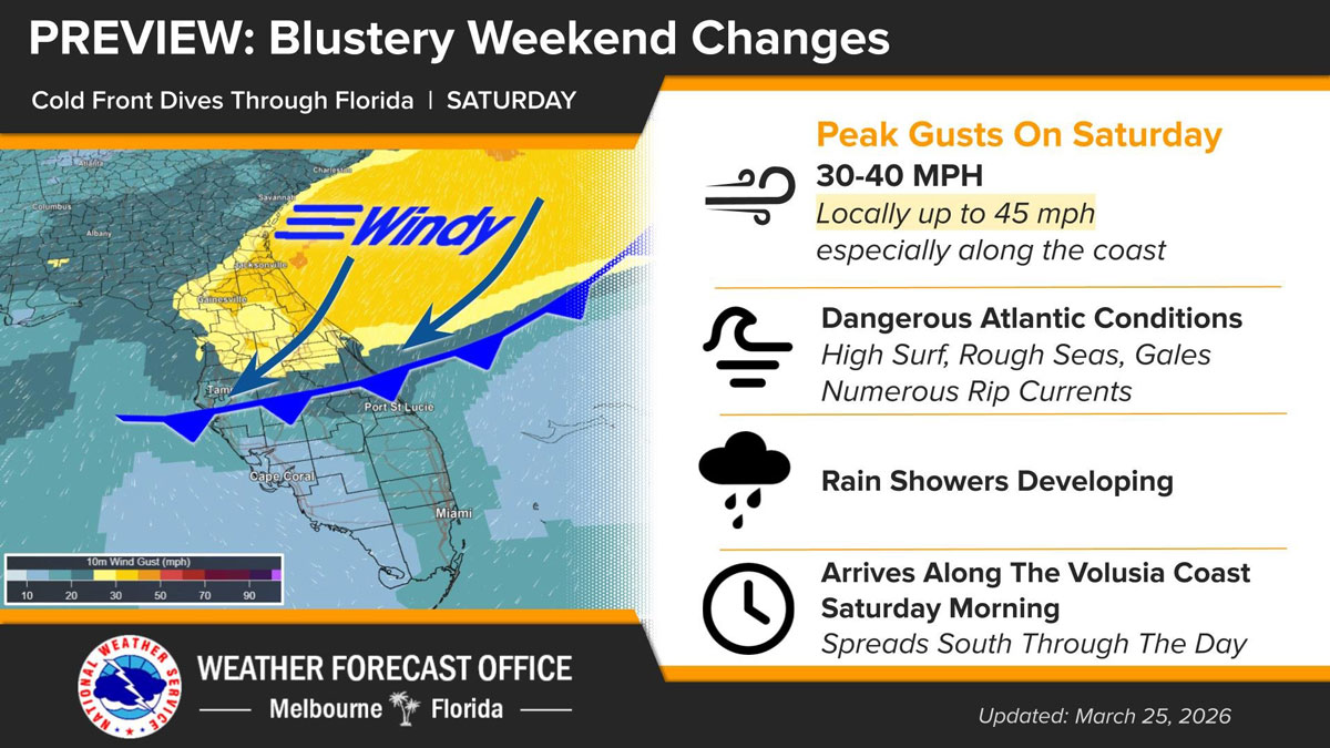
forecasters call for high surf, rough seas, and gale-force conditions
BREVARD COUNTY, FLORIDA – A strong cold front is set to push through Florida this weekend, bringing gusty winds, hazardous ocean conditions, and scattered rain showers across the Space Coast and surrounding areas.
According to the National Weather Service in Melbourne, the front will arrive along the Volusia County coastline early Saturday morning before steadily moving south throughout the day. As the system advances, conditions are expected to deteriorate, particularly along the coast.
Wind will be the primary concern, with sustained breezy conditions and peak gusts ranging from 30 to 40 mph. Along coastal areas, gusts could reach as high as 45 mph at times, creating potentially hazardous conditions for boaters and beachgoers.
The Atlantic Ocean is expected to become increasingly dangerous, with forecasters calling for high surf, rough seas, and gale-force conditions. Numerous rip currents are also likely, making swimming strongly discouraged.
In addition to the wind and surf, rain showers are expected to develop as the front moves through, adding to the unsettled weather pattern throughout the day Saturday.
Residents are advised to secure loose outdoor items, use caution while driving—especially in high-profile vehicles—and avoid entering the ocean during periods of rough surf.
Conditions are expected to gradually improve after the front passes, though breezy weather may linger into the latter part of the weekend.


