storm threat covers communities from Daytona Beach south through Melbourne, Palm Bay
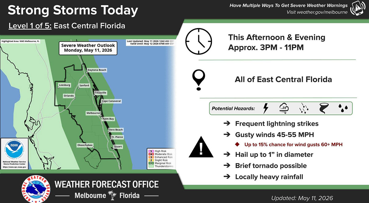
The National Weather Service in Melbourne is warning residents across East Central Florida to prepare for strong to potentially severe storms Monday afternoon and evening, with hazardous weather expected between approximately 3 p.m. and 11 p.m. (NWS Image)
BREVARD COUNTY, FLORIDA – The National Weather Service in Melbourne is warning residents across East Central Florida to prepare for strong to potentially severe storms Monday afternoon and evening, with hazardous weather expected between approximately 3 p.m. and 11 p.m.
According to the latest Severe Weather Outlook issued Monday, the entire East Central Florida region, including Brevard County, is under a Level 1 of 5 Marginal Risk for severe weather.
Forecasters say the primary threats include frequent lightning strikes, gusty winds of 45 to 55 mph, hail up to 1 inch in diameter, locally heavy rainfall, and the possibility of a brief tornado. There is also up to a 15% chance for isolated wind gusts exceeding 60 mph.
The storm threat covers communities from Daytona Beach south through Melbourne, Palm Bay, Vero Beach, Fort Pierce and surrounding inland areas.
Outdoor plans may need to be adjusted as storms develop, especially during the late afternoon and evening commute.
Stronger storms could produce dangerous lightning, sudden downpours and isolated severe conditions with little warning.
The National Weather Service advises residents to seek shelter indoors immediately if thunderstorms approach and to monitor updated forecasts as conditions evolve.