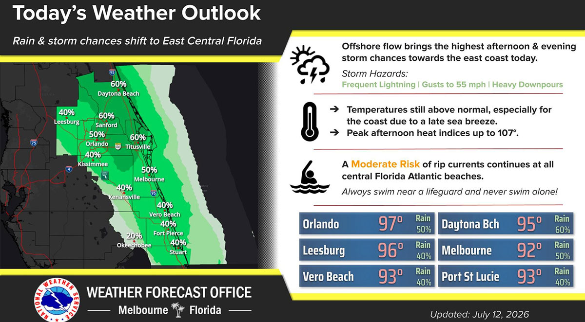
Hot and humid conditions will continue across Brevard County on Sunday as an offshore wind pattern pushes the highest chance of afternoon and evening showers and thunderstorms toward Florida’s Space Coast.
BREVARD COUNTY, FLORIDA — Hot and humid conditions will continue across Brevard County on Sunday as an offshore wind pattern pushes the highest chance of afternoon and evening showers and thunderstorms toward Florida’s Space Coast.
Forecasters say the offshore flow will delay the arrival of the Atlantic sea breeze, allowing temperatures to climb higher across Brevard before storms develop later in the day. Afternoon highs are expected to reach the low to mid-90s, while peak heat index values could soar to 107 degrees.
Residents are encouraged to stay hydrated, limit strenuous outdoor activities during the hottest part of the afternoon, wear lightweight clothing, and check on children, older adults, and pets.
Scattered showers and thunderstorms are expected to develop during the afternoon and evening, with the greatest rain chances occurring across Brevard County and the immediate east coast.
Some storms could become strong, producing frequent lightning, wind gusts up to 55 mph, and heavy downpours that may cause brief localized flooding and reduced visibility on area roadways.
Beachgoers should also exercise caution, as a moderate risk of rip currents remains in effect at Brevard County beaches. Swimmers are urged to only enter the water near lifeguards and never swim alone.
Residents and visitors should remain weather-aware throughout the day as the combination of dangerous heat, afternoon thunderstorms, and hazardous surf conditions could create rapidly changing conditions across the Space Coast.