Home » Home » Tropical Development Chances Decrease for AL92, AL94 in Atlantic Basin
Tropical Development Chances Decrease for AL92, AL94 in Atlantic Basin
AL92 could still bring strong gusty winds and heavy rain to portions of the Lesser Antilles on Saturday
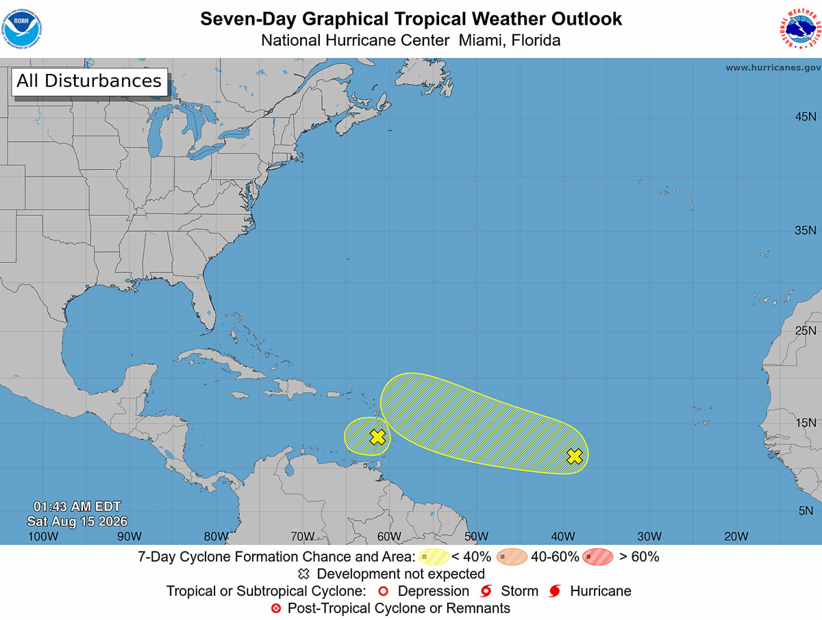
BREVARD COUNTY, FLORIDA – The National Hurricane Center is monitoring two tropical waves across the Atlantic basin, but neither system is expected to develop significantly over the next several days.
In its 2 a.m. Tropical Weather Outlook on Saturday, Aug. 15, the NHC reported that Invest 92L, located near the Windward Islands, continues to produce gusty winds, showers and thunderstorms.
However, the tropical wave is moving into an environment with stronger upper-level winds and drier air, causing its development potential to decrease.
The system now has only a 10 percent chance of formation through both the next 48 hours and seven days.
Although tropical cyclone development is highly unlikely, portions of the Lesser Antilles could experience strong gusty winds nearing gale force and areas of heavy rainfall throughout Saturday.
Farther east, Invest 94L is located over the central tropical Atlantic, more than 1,000 miles west of the Cabo Verde Islands. The tropical wave continues to produce disorganized showers and thunderstorms.
Some slow development is possible during the next couple of days, but the system is then expected to encounter strong upper-level winds that would further limit its chances of organizing.
Invest 94L has a 20 percent chance of formation through the next 48 hours and seven days.
Neither system currently poses an immediate threat to Florida. Residents should continue monitoring future forecasts as conditions across the tropics can change.