Home » Home » Weather System in Gulf Has 80% Chance of Development Into Tropical Storm Isaias
Weather System in Gulf Has 80% Chance of Development Into Tropical Storm Isaias
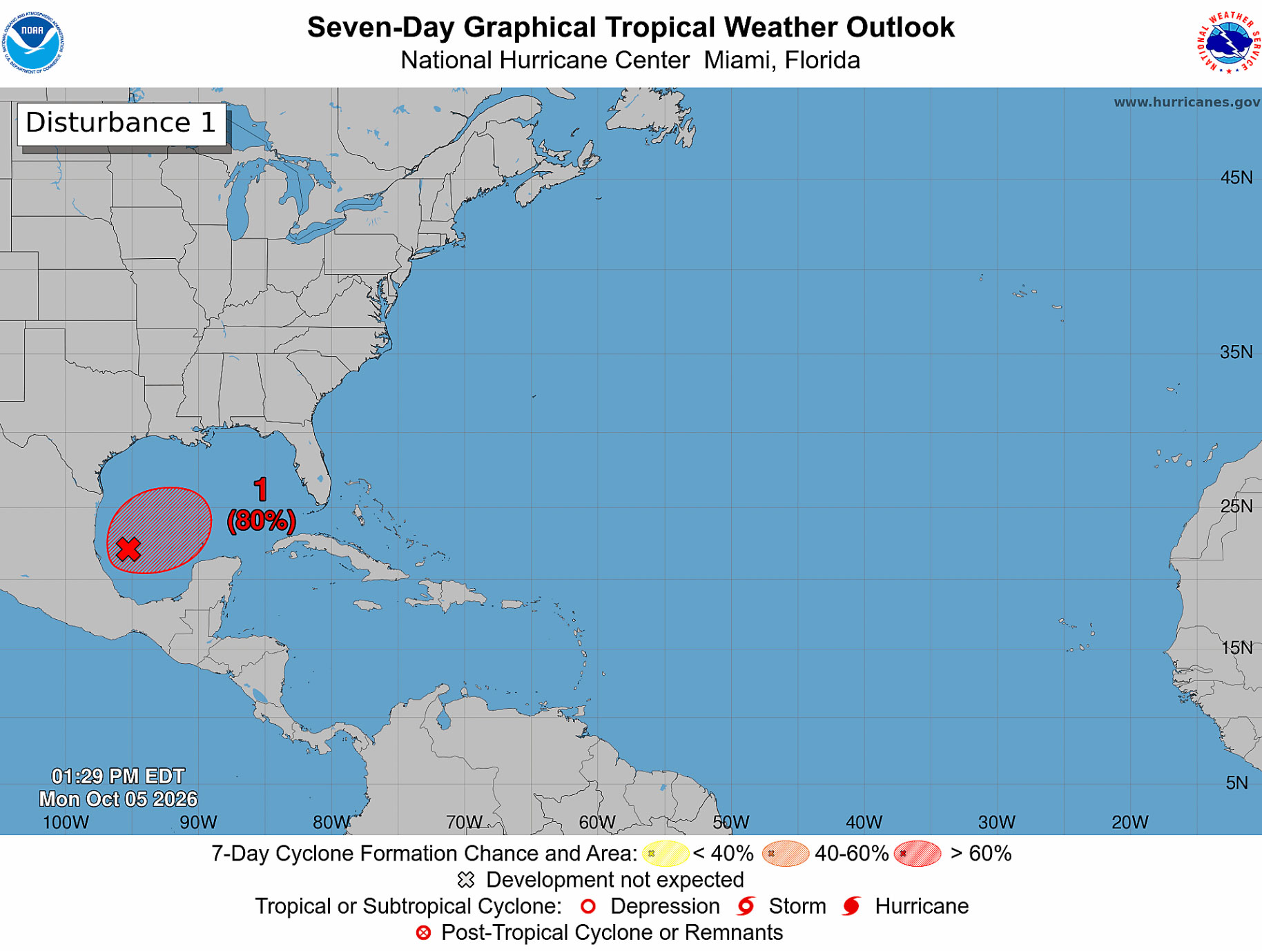
BREVARD COUNTY, FLORIDA — A disturbance in the southwestern Gulf of America is increasingly likely to become a tropical depression this week, but its potential effects on Brevard County remain uncertain.
The National Hurricane Center’s 2 p.m. Monday outlook identified the system as AL92 and gave it a 60% chance of development within 48 hours and an 80% chance within seven days. nhc.noaa.gov
The trough of low pressure is producing scattered, poorly organized showers and thunderstorms.
Despite only marginally favorable environmental conditions, forecasters expect gradual organization, with a tropical depression likely to form around the middle of the week.
The disturbance is forecast to drift eastward over the next couple of days before turning northward. Forecasters said it remains too early to determine specific impacts along the northern Gulf Coast and urged residents there to closely monitor its progress.
For residents in Brevard County, the outlook does not establish a direct threat to the Space Coast.
The development percentages describe the likelihood of a tropical system forming, rather than the likelihood of it striking a particular location. Its eventual track and strength will determine whether local impacts become a concern.
Meanwhile, the National Weather Service in Melbourne is forecasting a wet pattern across east central Florida this week as a frontal boundary stalls over the region. Heavy showers could cause water to collect on roads and produce minor flooding in low-lying areas. Increasing winds and building seas are also expected to create hazardous boating conditions across portions of the local Atlantic waters around midweek.
Brevard County residents should follow updates from the National Hurricane Center and National Weather Service in Melbourne as the Gulf disturbance becomes better organized and its potential path becomes clearer.