
NWS: Cold Front Passing Through Brevard Forecast to Bring Severe Weather to Space Coast Over the Weekend
By Space Coast Daily // January 6, 2024
active subtropical jet stream will continue sending a series of cold fronts toward Florida over the next week
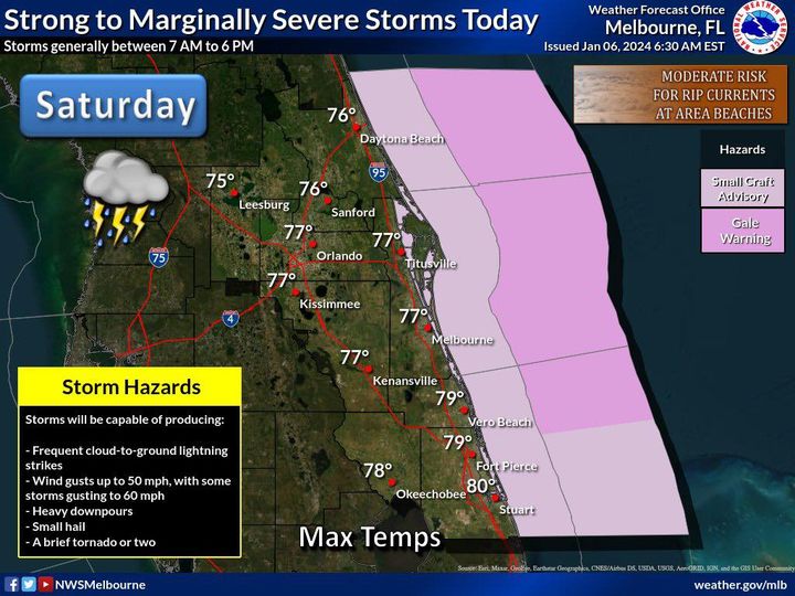
NATIONAL WEATHER SERVICE • MELBOURNE, FLORIDA – A cold front passing through Brevard County on Saturday is forecast to bring severe weather to the Space Coast over the weekend, into next week.
According to the National Weather Service in Melbourne, an active subtropical jet stream will continue sending a series of cold fronts toward Florida over the next week, with the strongest fronts forecast to arrive on Saturday and then again Tuesday.
The main threats will be lightning strikes and gusty winds, and hail and a few tornadoes are possible across the region.
Wind gusts of 25 to 35 mph are expected, with the potential for locally strong storms and heavy rain with the fronts as they pass through.
Additional threats include frequent lightning strikes, locally strong wind gusts of 45 to 55 mph. One or two of those gusts may reach 60 mph, and there could be some small hail as well.
 Related Story:
HOT OFF THE PRESS! December 25, 2023 Space Coast Daily News – Brevard County’s Best Newspaper