High Rain Chances Continue Across Brevard as Temperatures Remain in the 90s
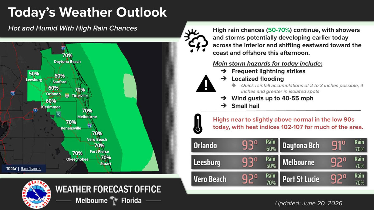
People in Brevard County should prepare for another hot and humid day Saturday as scattered showers and thunderstorms are expected to develop earlier than usual and move toward the coast through the afternoon. (NWS Image)
BREVARD COUNTY, FLORIDA – People in Brevard County should prepare for another hot and humid day Saturday as scattered showers and thunderstorms are expected to develop earlier than usual and move toward the coast through the afternoon.
According to the National Weather Service in Melbourne, rain chances remain high at 70 percent across much of the Space Coast, including Titusville, Melbourne, and areas southward.
Forecasters say storms are likely to form inland during the late morning and early afternoon, then shift east toward coastal communities and offshore later in the day.
Some storms could become strong, bringing frequent lightning, wind gusts of 40-55 mph, small hail, and heavy rainfall that could produce localized flooding.
Meteorologists warn that quick rainfall totals of 2 to 3 inches are possible, with isolated locations receiving more than 4 inches in a short period.
While temperatures will be slightly lower than recent days, conditions will remain uncomfortable. Afternoon highs are expected to reach the low 90s, including around 92 degrees in Melbourne and Vero Beach.
Combined with high humidity, heat index values could climb between 102 and 107 degrees across much of east-central Florida.
Drivers are encouraged to use caution during heavy downpours, especially in low-lying and flood-prone areas.
Residents heading outdoors should stay weather aware, seek shelter immediately when thunder is heard, and remain hydrated as dangerous heat and humidity persist.
The unsettled weather pattern is expected to continue through the weekend, with additional rounds of showers and thunderstorms possible each afternoon.