How 3D Architectural Animation Brings New Developments to Life
By Space Coast Daily // September 23, 2026
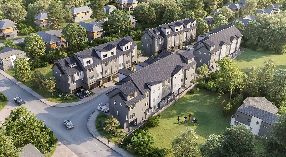
Communities can imagine what the new development will look like by creating a short film using 3D architectural animation from a flat plan. It presents a project at a visitor’s level; it’s in real light; it’s beside roads that they know. A site plan is not cryptically set up for residents to decipher. They can “walk” past the future building and feel how high it will be from the sidewalk and estimate where it will place traffic, shade, and green space. This common perspective creates a more peaceful atmosphere at public gatherings, more precise questioning, and more helpful feedback for all.
Why communities struggle to picture new developments on paper
Planning documents are written for professionals. Setback lines, elevations, and zoning codes make sense to an architect, but most neighbors see a grid of shapes and numbers. The research backs this up. In a 2025 study presented at the CHI conference on human-computer interaction, researchers watched residents use a standard 2D planning platform, and 19 out of 20 found its map layers and technical terms confusing.
That gap is where real estate 3D rendering earns its place. One photoreal image can show the facade, materials, and landscaping of a proposed development in a way no drawing can. Developers make these images for sales brochures. Yet the same visuals often end up on a county website or projected in a council chamber. There they do quiet but important work: they give everyone the same starting image.
Picture a typical hearing. A neighbor asks, “Will it block my view of the river?” The architect points to a section drawing, and nobody in the room is convinced. Now show that neighbor a camera view from their own street corner. The conversation shifts from fear to specifics.
What 3D architectural animation shows that drawings can’t
A still freeze, a single moment from a single angle. Sequence is the experience of a place; a place is sequenced by motion. In less than a minute, a good 3D architectural animation can fly from an aerial view all the way down to the sidewalk, through a lobby, and up to a rooftop terrace. Since 2018, some studios like Pixready have been assisting architects, real estate developers, and product brands in creating these sequences, with a successful completion of over 1500 projects. Animation offers their team possibilities for camera moves they could never make with a film crew: “Cut away sections where they wouldn’t be able to go or a gradual change from inside a building to the street outside of it; that kind of thing.”
Animation builds on real estate 3D rendering rather than replacing it. The same model that produces the brochure still is simply set in motion. Here’s what that motion reveals:
• How scale feels at street level, not just how tall a building is on paper.
• The route a pedestrian or driver will take through the site.
• How sunlight and shadow move across a plaza from morning to evening.
• How the new building sits beside existing homes, trees, and roads.
• Where parking, entrances, and deliveries actually go.
| Format | What residents grasp quickly | Common blind spot |
| 2D site plan | Lot lines, footprint, setbacks | Height, mood, street feel |
| Still rendering | Materials, style, landscaping | Only one chosen angle |
| Animation or walkthrough | Scale, movement, context | Can look “too perfect” |
How architectural visualization shapes community planning
Real cities are already testing this. When the Finnish city of Turku piloted 3D models in public consultation, planners found residents understood the plan better than on a traditional 2D map and had an easier time commenting on it. Back in the CHI study, six of eight non-expert participants said the 3D view helped them understand planning proposals better than flat drawings.
For urban development teams, that clarity pays off in a practical way. Feedback arrives early, when design changes are still cheap. An objection about a blank wall facing a park can be fixed on screen in a day instead of argued over for months.
What went wrong: when 3D visuals backfire
Visualization is not magic. In one public participation experiment, researchers saw that rough models, with details like windows simply copied and repeated, left people doubting that 3D could show reality accurately. Cheap visuals can erode trust instead of building it. Turku’s planners also flagged a timing problem: first consultations often happen while a plan is still a rough draft, which makes a precise model hard to build. The lesson is simple. Be clear about what is fixed and what is still open, and label early videos as concepts.
The math behind a minute of 3D building animation
Why does an architectural walkthrough cost more than a set of stills? Frames. Video usually plays at 30 frames per second, and each frame is a full render.
| Video length | Frames at 30 fps |
| 30 seconds | 900 |
| 60 seconds | 1,800 |
| 90 seconds | 2,700 |
Try a quick estimate. If each frame takes five minutes on one computer, a 90-second film needs 13,500 minutes, or about 225 hours. Compared with real estate 3D rendering of a single view, that’s a huge jump in workload. It explains why studios use render farms, and why a single still image is often quoted at three to five business days while animations take longer. For towns reviewing future development projects, this is a useful reality check: ask for the video early, not the week before the vote.
Helping communities picture what comes next
A new building shapes a neighborhood for decades. People deserve to see that change clearly before it is approved, not after the cranes leave. In real estate, 3D rendering started as a sales tool. Its bigger value may be civic: one shared picture that residents, planners, and developers can question, improve, and finally agree on. The same real estate 3D rendering that sells a condo can help a room full of neighbors ask better questions. And better questions usually lead to better buildings.