Hurricane Idalia Makes Landfall on Florida as Strong Category 3, Moves Inland as Category 2 Hurricane
By Space Coast Daily // August 30, 2023
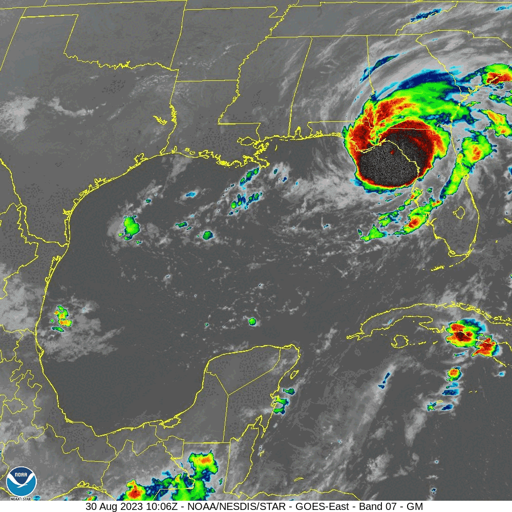
 BREVARD COUNTY, FLORIDA – National Hurricane Center clocked Hurricane Idalia as a strong Category 3 hurricane when it made landfall on Florida Wednesday morning.
The system is moving to the north-northeast at 18 mph and carrying 120 mph.
The eye of Hurricane Idalia was located by Tallahassee radar near latitude 29.9 North, longitude 83.5 West. Idalia is moving toward the north-northeast near 18 mph.
A north-northeastward motion is expected through the morning, with Idalia’s center forecast to move into southern Georgia later today.
Idalia is forecast to turn toward the northeast and east-northeast, moving near or along the coasts of Georgia, South Carolina, and North Carolina late today and Thursday.
Maximum sustained winds are estimated near 120 mph with higher gusts. Idalia is a category 3 hurricane on the Saffir-Simpson Hurricane Wind Scale. Although Idalia will weaken further now that the center is inland, it is likely to still be a hurricane while moving across southern Georgia, and near the coast of Georgia or southern South Carolina late today.
Idalia is forecast to be a tropical storm while moving near the coasts of northeastern South Carolina and North Carolina tonight and on Thursday.
Hurricane-force winds extend outward up to 25 miles from the center and tropical-storm-force winds extend outward up to 175 miles (280 km).
The minimum central pressure is 950 mb based on aircraft data.
Water levels along the coast of the Florida Big Bend continue to rise rapidly.
A NOAA National Ocean Service tide gauge at Cedar Key, Florida, recently reported a water level of 6.2 feet above mean higher high water, which is an approximation of inundation in that area.
The combination of storm surge and tide will cause normally dry areas near the coast to be flooded by rising waters moving inland from the shoreline. The water could reach the following heights above ground somewhere in the indicated areas if the peak surge occurs at the time of high tide…
Wakulla/Jefferson County, FL to Yankeetown, FL…12-16 ft
Ochlockonee River, FL to Wakulla/Jefferson County, FL…8-12 ft
Yankeetown, FL to Chassahowitzka, FL…7-11 ft
Chassahowitzka, FL to Anclote River, FL…6-9 ft
Carrabelle, FL to Ochlockonee River, FL…5-8 ft
Anclote River, FL to Middle of Longboat Key, FL…4-6 ft
Tampa Bay…4-6 ft
Indian Pass, FL to Carrabelle, FL…3-5 ft
Middle of Longboat Key, FL to Englewood, FL…3-5 ft
Saint Catherines Sound, GA to South Santee River, SC…3-5 ft
Englewood, FL to Bonita Beach, FL…2-4 ft
Beaufort Inlet, NC to Ocracoke Inlet, NC…2-4 ft
Mouth of the St. Mary’s River to Saint Catherines Sound, GA…2-4 ft
Charlotte Harbor…2-4 ft
Neuse and Bay Rivers…2-4 ft
Pamlico and Pungo Rivers…2-4 ft
Flagler/Volusia County Line, FL to Mouth of the St. Mary’s
River…1-3 ft
Mexico Beach, FL to Indian Pass, FL…1-3 ft
Bonita Beach, FL to East Cape Sable, FL…1-3 ft
South Santee River, SC to Beaufort Inlet, NC…1-3 ft
Ocracoke Inlet, NC to Duck, NC…1-3 ft
The deepest water will occur along the immediate coast near and to the right of the center, where the surge will be accompanied by large and destructive waves. Surge-related flooding depends on the relative timing of the surge and the tidal cycle, and can vary greatly over short distances. For information specific to your area, please see products issued by your local National Weather Service forecast office.
Governor Ron DeSantis and First Lady Casey DeSantis announced the activation of the Florida Disaster Fund to support communities impacted by Hurricane Idalia. The fund is a component of the Volunteer Florida Foundation, Florida’s official 501(c)(3) charitable organization that supports volunteerism, community service, and disaster recovery


